
Mullaleam [Mullach Leim]
Good walks are even better shared.
Overview
Mullaleam [Mullach Leim]
Introduction
Mullaleam, or Mullach Leim, stands proudly at 705 meters in the beautiful Mourne Mountains of Northern Ireland. Known for its rugged beauty and stunning panoramas, this hill is a must-visit for hikers looking for a taste of adventure.
Geology
The geology of Mullaleam is primarily dominated by granite and quartzite, giving it a robust and rugged characteristics typical of the Mourne Mountains. These ancient rocks tell a tale of tectonic movements that have sculpted this beautiful landscape over countless ages.
Routes
One of the best routes to the summit follows the Mourne Wall, which encircles the mountainous area. This 8-kilometer trek takes approximately 3.5 hours and provides an excellent opportunity to take in the natural beauty of the region. With its moderate difficulty, it's suitable for most hikers looking to stretch their legs.
Summit Features
At the summit, you'll find a small cairn marking your achievement, complete with a view that can make even the most seasoned hiker pause in admiration. It’s the perfect spot for a well-earned sandwich and a few selfies.
Terrain
The terrain on the way up Mullaleam varies from rocky outcrops to grassy patches, with some boggy bits to keep you on your toes. Be sure to wear sturdy boots; the last thing you want is to end up knee-deep in muck while trying to enjoy the view!
Views
When you reach the summit, prepare to be awestruck! The surrounding Mourne Mountains create a breathtaking backdrop, with the possibility of viewing the Isle of Man on a particularly clear day. Spring and autumn generally provide the clearest views—and if you're lucky, you might catch a sunset that will make you believe you've stepped into a painting.
Hazards
While Mullaleam is relatively accessible, it's worth noting that mountain weather is notoriously fickle. Be prepared for rapid changes, as well as slippery areas and sudden bogs that will try their best to catch you off guard!
Nearby Summits
Mullaleam is nestled between some of the highest peaks in the Mourne range. Don't forget to check out nearby Slieve Donard (850 meters) and Slieve Commedagh (765 meters) for even more spectacular views and varied hiking experiences.
Access
Getting to Mullaleam is pretty easy. The nearest parking is located in the Donard Park car park in Newcastle, though spaces can feel tighter than a pair of old boots during busy periods. If you’re relying on public transport, regular buses run from Belfast to Newcastle, making it accessible for everyone eager to lace up their hiking boots.
Facilities
Before and after your hike, the nearby town of Newcastle offers plenty of charming cafes and pubs, as well as public toilets—a must if you've had one too many cups of tea before hitting the trails.
History
The name Mullach Leim, which means 'Summit of the Leap', adds a layer of intrigue to this already captivating mountain. It hints at an old-world connection to livestock that might have made leaps and bounds around the area. The Mourne Mountains are rich in folklore and history, with ancient stories and myths still shared amongst locals today.
In conclusion, Mullaleam is more than just a hill; it’s a wellspring of beauty, history, and adventure ready for any hiking enthusiast.
So, grab your boots, pack a snack, and hit the trail!
Explore routes near Mullaleam [Mullach Leim]
Public walks starting within 80 km of this hill. Nearby does not mean a route reaches the summit; check its map and access before setting out.
Florence Court: Riverside and Forest Circuit, County Fermanagh
View route
Peatlands Park Red Trail: Annagarriff Wood and Derryadd Lough
View route
Route planning notes
These notes describe possible approaches, not verified navigable routes or permission to cross land. Check current paths, local access rules and conditions before setting out.
Ascend via the Mourne Wall
This classic route follows the iconic Mourne Wall, leading hikers through stunning landscapes and up to the summit.
Make a day of it, together
Find someone to share the walk with, or organise a day out along a route you like.
Hill facts and local notes
Classifications
Elevation
424m
1,391 ft
Prominence
104m
Coordinates
54.2358, -7.7676
H152319
OS Map
26
At the Summit
The summit of Mullaleam is marked by a small cairn, offering a perfect spot for a well-deserved snack and panoramic views.
Terrain & Geology
Mullaleam is primarily composed of granite and quartzite, typical of the Mourne Mountains, showcasing the area's tectonic history and geological activity that has shaped these rugged terrains over millennia.
Views & Scenery
From the summit, you can feast your eyes on breathtaking views of the surrounding Mourne Mountains and the coastal scenery beyond. On a clear day, you can even spot the distant Isle of Man!
History & Heritage
Name Origin
Mullach Leim translates to 'Summit of the Leap', possibly referring to the steep ascent or jumps made by livestock navigating the area.
Historical Significance
The Mourne Mountains are steeped in folklore and history, with ancient rituals and tales of mythical creatures often told around campfires.
Getting There & Facilities
Check current local access restrictions, parking rules and transport timetables before travelling. These notes do not confirm public access to the summit.
Parking
The nearest parking is at the Donard Park car park, just south of Newcastle, with spaces limited during peak visiting times.
Public Transport
Regular bus services operate from Belfast to Newcastle, providing a convenient option for those relying on public transport.
Nearby Facilities
Newcastle offers a good selection of cafes, pubs, and public toilets, perfect for a pre-hike cuppa or post-hike pint.
Safety Information
Known Hazards
- Watch out for sudden weather changes typical in the mountains, as well as slippery rocky sections and hidden bogs.
General Safety Tips
- Check weather conditions before setting out
- Carry appropriate clothing and equipment
- Let someone know your planned route
- Take a map, compass, and GPS device
- Carry emergency supplies: food, water, first aid kit, torch
Hills
Some common questions about the hills answered
Are there group walks up Mullaleam [Mullach Leim]?
Many walkers use Walkmates to join or organise walks with others. You can check for group walks around Mullaleam [Mullach Leim] through the maps
Are there other walkers around Mullaleam [Mullach Leim]?
Activity varies by location and time, but Walkmates lets you see whether others have shared walks or shown interest in this area. Find other people through the walking friends search walking friends for Mullaleam [Mullach Leim] search or of course create your own walk for Mullaleam [Mullach Leim]
Can I organise a walk to Mullaleam [Mullach Leim]?
Yes. If there aren’t any walks listed already, you can create a walk and make it available for others to join.
If you're signed up to Walkmates, you can create a walk to Mullaleam [Mullach Leim].
How do I find a walk up this hill?
There are often multiple ways to walk this hill, depending on experience and route preference. Walkmates helps you explore walks and routes that others have shared.
Can I suggest a new route up Mullaleam [Mullach Leim]?
Yes. You can suggest or create routes to share with others. Walkmates focuses on the social side of walking, so routes are used to help people organise walks and explore areas together, rather than as detailed navigation tools or route libraries.
Other uses really appreciate knowledgeable walkers sharing their routes. Share your favourite route to Mullaleam [Mullach Leim] here
The is an error or something incorrect about this hill. How do I let you know?
We always strive to keep the information on Walkmates as accurate as possible. If you find an error, please let us know through the contact form and we'll aim to correct it as quickly as possible
Community Discussion
Comments
Location
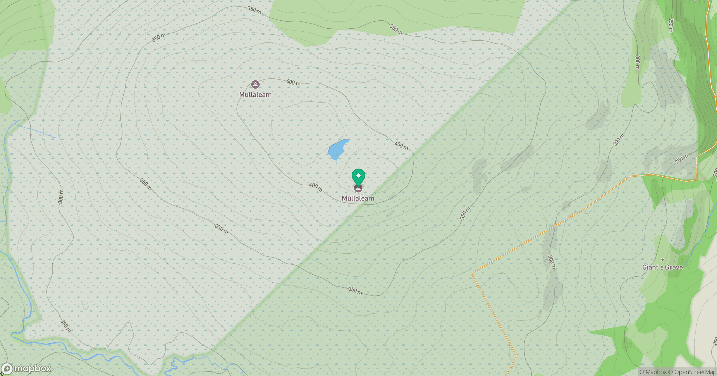
Grid reference: H152319
View on OpenStreetMapOpens a map in a new tab, centred on the hill.
Hills within 30 km
Straight-line distance, not a walking route or confirmation of access.
No comments yet. Be the first.